Walks
Walks index > Circular and Linear Walks in Lincolnshire Wolds
I'm always adding, there's lots more to come!
You may prefer to view the interactive map version of this page.
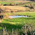
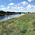
Lindsey Trail / Viking Way Circular Walk 1
Distance: 8.5 miles
Terrain: first half flat, second half 500ft elevation gain
Location: Lincolnshire
On Map: Ordnance Survey Explorer 282
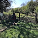
Lindsey Trail Circular Walk 2
Distance: 9.5 miles
Terrain: 100ft elevation gain, hardly noticeable
Location: Lincolnshire
On Map: Ordnance Survey Explorer 282
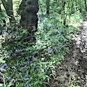
Viking Way: Ludford to Donington on Bain
Distance: 7 miles, or 14 if walked there and back
Terrain: some inclines
Location: Lincolnshire
On Map: Ordnance Survey Explorer 282
Viking Way: Donington on Bain to Fulletby
Distance: 9 miles, or 18 if walked there and back
Terrain: some inclines
Location: Lincolnshire
On Map: Ordnance Survey Explorer 282 and Ordnance Survey Explorer 273
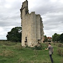
Viking Way: 'Shadow of Juicetrump' Circular
Distance: 5 miles
Terrain: some inclines
Location: Lincolnshire
On Map: Ordnance Survey Explorer 273
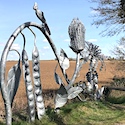
Viking Way: Horncastle to Woodhall Spa Sculpture trail
Distance: 6.5 miles
Terrain: flat
Location: Lincolnshire
On Map: Ordnance Survey Explorer 273
Viking Way: Stixwould to Bardney
Distance: 6.5 miles
Terrain: flat
Location: Lincolnshire
On Map: Ordnance Survey Explorer 273
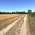
Viking Way: Bardney/Stainfield to Fiskerton
Distance: 6 or 9 miles
Terrain: flat
Location: Lincolnshire
On Map: Ordnance Survey Explorer 273 and Explorer 272
Viking Way: Fiskerton to Lincoln
Distance: 5 or 10 miles, alternate 5 mile circular
Terrain: flat
Location: Lincolnshire
On Map: Ordnance Survey Explorer 272
Viking Way: Long Benington to Woolsthorpe
Distance: 7.3 miles
Terrain: some inclines
Location: Lincolnshire
On Map: Ordnance Survey Explorer 247
Viking Way: The Drift
Distance: 7 miles
Terrain: some inclines
Location: Lincolnshire
On Map: Ordnance Survey Explorer 247
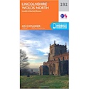
These walks use Ordnance Survey Explorer 282 Lincolnshire Wolds North
1:25,000 scale map Lincolnshire Wolds North. Click the thumbnail for more images
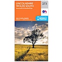
These walks use Ordnance Survey Explorer 273 Lincolnshire Wolds South
1:25,000 scale map Lincolnshire Wolds South. Click the thumbnail for more information
Note that OS paper maps now include the digital / mobile map, downloadable and viewable *offline* in the OSMaps app. The routes provided on these pages in GPX format will open and display over the digital mapping in the OSMaps app.
View Ordnance Survey Explorer 273 Lincolnshire Wolds South at Amazon
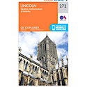
These walks use Ordnance Survey Explorer 272 Lincoln
1:25,000 scale map Lincoln. Click the thumbnail for more information
Note that OS paper maps now include the digital / mobile map, downloadable and viewable *offline* in the OSMaps app. The routes provided on these pages in GPX format will open and display over the digital mapping in the OSMaps app.
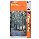
These walks use Ordnance Survey Explorer 247 Grantham
1:25,000 scale map incuding Bottesford & Colsterworth. Parts of Jubilee Way, Mowbray Way, Rutland Round and Viking Way are clearly marked.
Note that OS paper maps now include the digital / mobile map, downloadable and viewable *offline* in the OSMaps app. The routes provided on these pages in GPX format will open and display over the digital mapping in the OSMaps app.
Unlimited listening to thousands of titles:
