Walks
Viking Way: Donington on Bain to Fulletby
Distance: 9 miles
Terrain: some inclines
View / download the route
map: Ordnance Survey Explorer 282 (Lincolnshire Wolds North) and Ordnance Survey Explorer 273 (Lincolnshire Wolds South)
My last walk: 2 Sep 2021
 This is a linear route, which means that you will need to either walk the route and then retrace your steps (doubling the length of the walk) or arrange transport from one end to the other, or arrange to be dropped at one end and collected at the other. It includes the remains of two medieval villages and some beautiful countryside. The Viking Way is very well marked. I suggest parking in Donington on Bain and arrange to finish in Fulletby.
 Out of Donington, find Chapel Lane and pick up the Viking Way. This trail is well-signposted with discs featuring the viking symbol placed almost everywhere that you need to take a turn. Don't rely on these for navigation as there are a couple of spots where you won't spot them and will have to rely on a map or navigation aid to stay on-track. Between Donington and Goulceby, after a short section of road and some woods, you'll find yourself having to negotiate a small hill. The trick is to follow the contour around the hill, no need to climb over it.
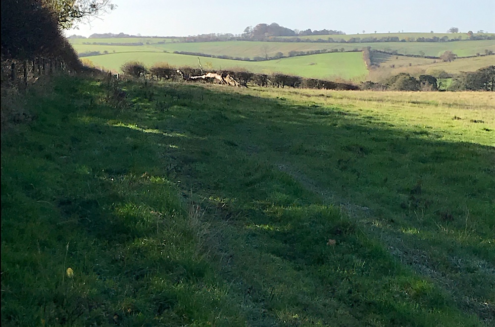
 As usual with the Viking Way, it crosses some beautiful open countryside. After Goulceby and Scamblesby, you can enjoy the splendidly-named Juicetrump hill. It's a wedge-shaped limestone outcrop, although its name is the most remarkable thing about it, all you'll really see from the right-of-way is a hill with some trees atop.
 Fulletby is a notable village. it's the second highest point in Lincolnshire Wolds at 450ft (137m) above sea level. It's said that on a clear day you can see Boston Stump and Lincoln Cathedral, as well as the Lincolnshire and Norfolk coasts.
Some of this route is on road. Take the usual precautions and stay safe.
blog posts about this walk:
View / download the route
Below is an interactive map with the route shown on it, which you can make full-screen. To take a paper map with you at the best detail, you will need an explorer (1:25,000) map. Please use the link below to buy a copy. Below the map is a link to download the GPX file which you can open in many mapping and navigation apps, including OsmAnd (Open Street Map) and OSMaps (Ordnance Survey)
Download GPX file for the Viking Way: Donington on Bain to Fulletby for use with other websites or your handheld device (right-click to save file)

This walk uses Ordnance Survey Explorer 282 Lincolnshire Wolds North
1:25,000 scale map Lincolnshire Wolds North. Click the thumbnail for more information
Note that OS paper maps now include the digital / mobile map, downloadable and viewable *offline* in the OSMaps app. The routes provided on these pages in GPX format will open and display over the digital mapping in the OSMaps app.
View Ordnance Survey Explorer 282 Lincolnshire Wolds North at Amazon

This walk uses Ordnance Survey Explorer 273 Lincolnshire Wolds South
1:25,000 scale map Lincolnshire Wolds South. Click the thumbnail for more information
Note that OS paper maps now include the digital / mobile map, downloadable and viewable *offline* in the OSMaps app. The routes provided on these pages in GPX format will open and display over the digital mapping in the OSMaps app.
View Ordnance Survey Explorer 273 Lincolnshire Wolds South at Amazon
Unlimited listening to thousands of titles:
