Walks
Viking Way: The Drift
Distance: 7 miles
Terrain: some inclines.
View / download the route
map: Ordnance Survey Explorer 247 (Grantham)
My last walk: 22 May 2023
 This is a linear route, which means that you will need to either walk the route and then retrace your steps (doubling the length of the walk) or arrange transport from one end to the other, or arrange to be dropped at one end and collected at the other. The route goes between two points which each have parking. The Viking Way is mostly very well-marked with fingerposts and the yellow Viking disc. Keep your wits about you and your map to hand.
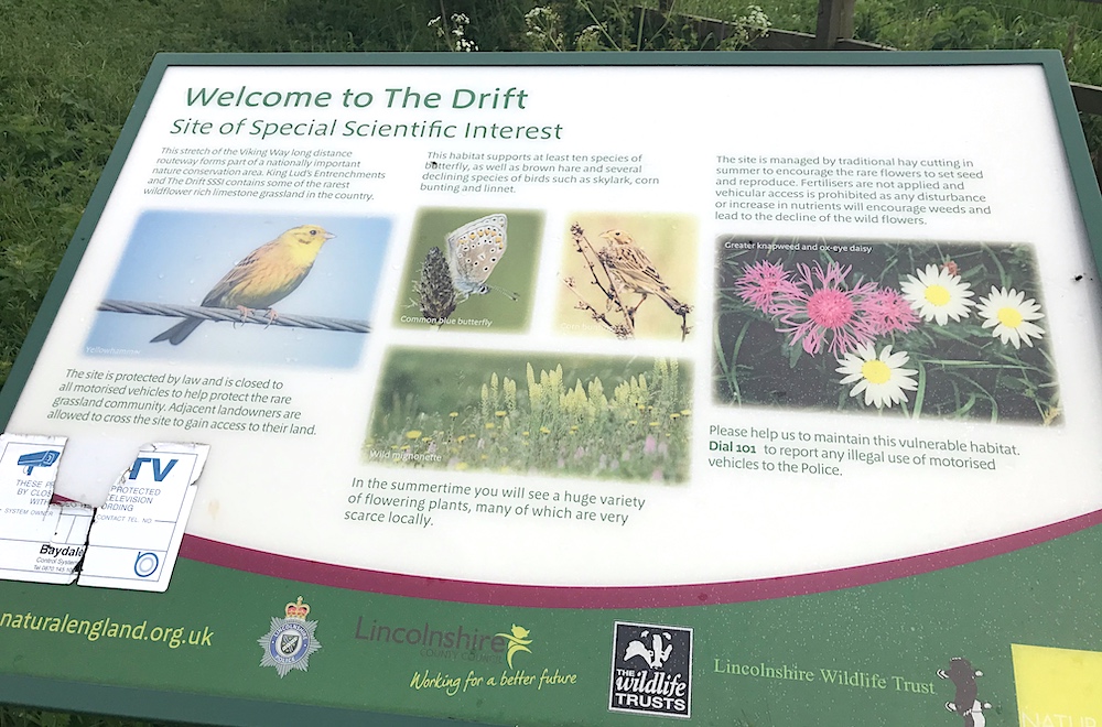
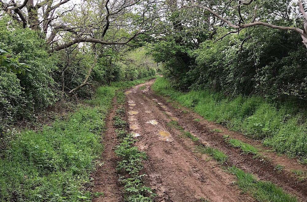 This is one of the more beautiful parts of the Viking Way. It's a Site of Special Scientific Interest (SSSI). In Spring it's festooned with beautiful wild flowers. Having said that, some of the tracks here are used for off-roading, resulting in deep ruts, mud and puddles which can make for difficult walking.
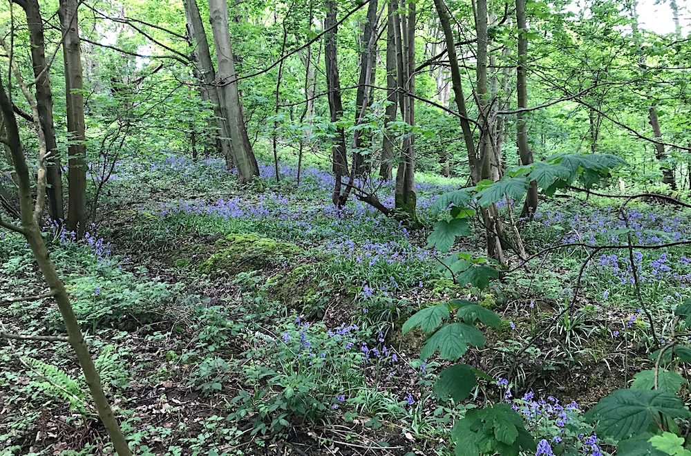
 In May there are displays of bluebells.

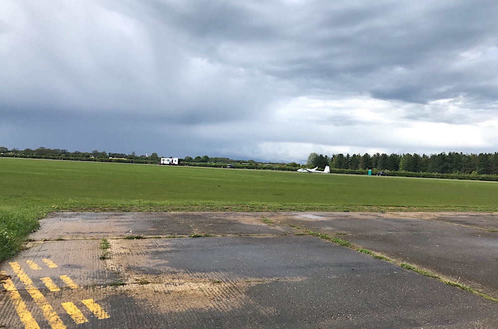 Towards the end of this walk is the Buckminster Gliding Club. Although the airfield seems to be in constant use by the club, these craft are launched and fly silently, so they don't intrude on this peaceful and beautiful walk. The footpath crosses the runway, which isn't a problem if you keep your wits about you and follow the marked path. You may enjoy seeing the gliders being launched into the air.
This route crosses roads. Take the usual precautions and stay safe.
blog posts about this walk:
View / download the route
Below is an interactive map with the route shown on it, which you can make full-screen. To take a paper map with you at the best detail, you will need an explorer (1:25,000) map. Please use the link below to buy a copy. Below the map is a link to download the GPX file which you can open in many mapping and navigation apps, including OsmAnd (Open Street Map) and OSMaps (Ordnance Survey)
Download GPX file for the Viking Way: The Drift for use with other websites or your handheld device (right-click to save file)
Ordnance Survey Explorer 247 Grantham
1:25,000 scale map incuding Bottesford & Colsterworth. Parts of Jubilee Way, Mowbray Way, Rutland Round and Viking Way are clearly marked.
Note that OS paper maps now include the digital / mobile map, downloadable and viewable *offline* in the OSMaps app. The routes provided on these pages in GPX format will open and display over the digital mapping in the OSMaps app.
Unlimited listening to thousands of titles:
