Walks
Viking Way: Fiskerton to Lincoln
Distance: 5 miles or 10 miles
Terrain: flat with some inclines once at Lincoln
View / download the route
map: Ordnance Survey Explorer 272 (Lincoln)
My last walk: 29 Sep 2022
 As it's a short distance from Fiskerton to Lincoln, you could walk it one way, walk there and back, or try a circular route starting / finishing in Lincoln
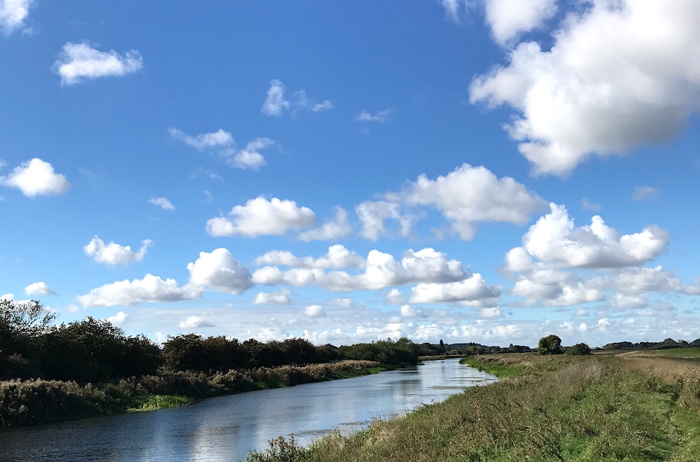
If you start / finish at Fiskerton, much of the walk is along the River Witham, which is extremely pleasant.
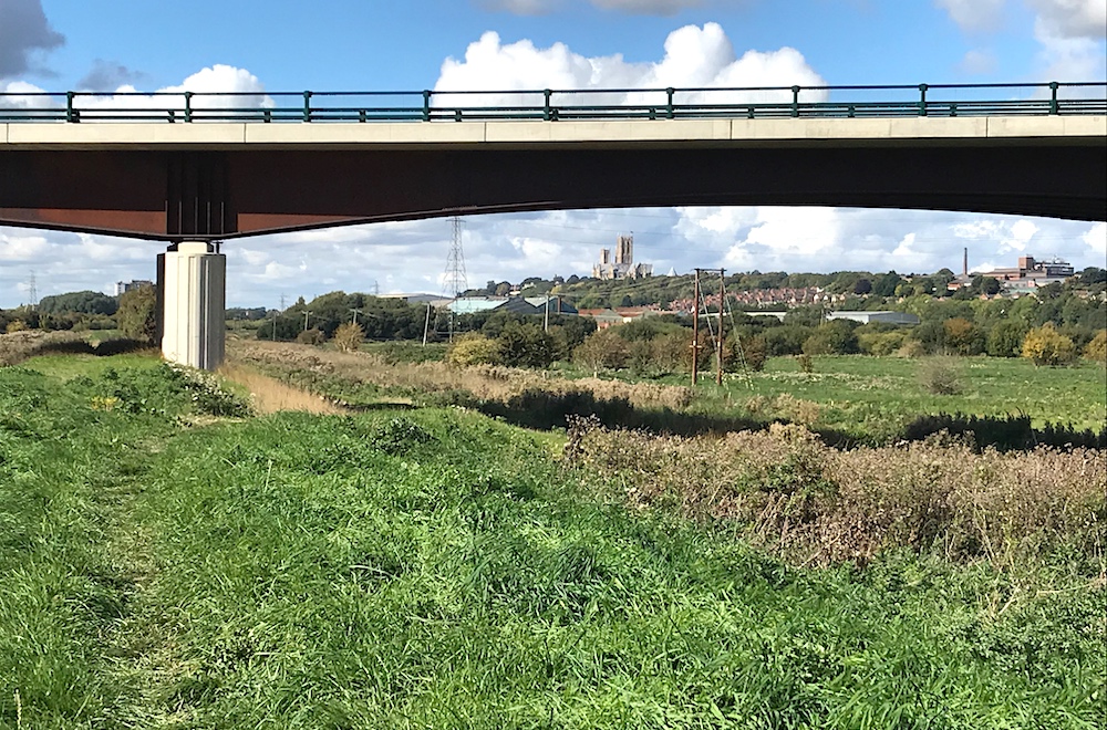 An aspect of this walk I particularly enjoyed was seeing the cathedral almost from the start and then watching it grow bigger as it came closer.
The landscape around Lincoln is very flat but the cathedral is built on a hill. A pretty steep hill, you discover as you walk through the city. (One street is called Steep Hill).
An aspect of this walk I particularly enjoyed was seeing the cathedral almost from the start and then watching it grow bigger as it came closer.
The landscape around Lincoln is very flat but the cathedral is built on a hill. A pretty steep hill, you discover as you walk through the city. (One street is called Steep Hill).
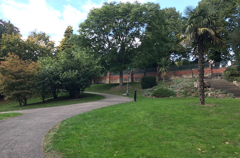 At TF018712 The Viking Way heads away from the river across fields, along a railway line and then into the city. This part is notable for going through a beautiful arboretum but otherwise there's quite a bit of city streets.
An alternative is to continue straight along the river, which arrives in the city by the Moonraker floating tearoom which I highly recommend.
 There is a little ambiguity - I did see a Viking Way disc along the more direct route into the city, but I don't think it is Viking Way. That part has green diamonds on the map, but it's part of the Spires and Steeples Trail.
This is where the options come in. You could walk from Fisketeron, take refreshment in Lincoln and walk back to Fiskerton using the Arboretum route back out of the city. You could simply retrace your steps. I've provided this direct 'linear' walk as the first GPX file below. I've created a second 5 mile circular route, which uses those sections of both the Viking Way and Spires and Steeples, starting and finishing in the city.
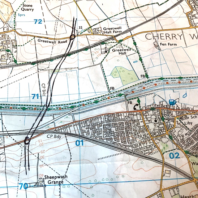 Note that there is a new road that may not be shown on your map. The Lincoln Eastern Bypass isn't shown on a freshly-purchased Explorer 272 and as I write this, not even shown in the OS digital map. It is shown in the interactive Open Streetmap routes I've embedded in the page below.
It crosses the railway line section at TF008716. Here is my own paper map with the new bypass penned in.
It's not serious but did cause us a little confusion while navigating the railway line section,
Some of this route is on road. Take the usual precautions and stay safe.
blog posts about this walk:
View / download the route
Below is an interactive map with the route shown on it, which you can make full-screen. To take a paper map with you at the best detail, you will need an explorer (1:25,000) map. Please use the link below to buy a copy. Below the map is a link to download the GPX file which you can open in many mapping and navigation apps, including OsmAnd (Open Street Map) and OSMaps (Ordnance Survey)
Download GPX file for the Viking Way: Fiskerton to Lincoln for use with other websites or your handheld device (right-click to save file)
Download GPX file for the Lincoln Viking Way / Spires and Steeples circular for use with other websites or your handheld device (right-click to save file)

This walk uses Ordnance Survey Explorer 272 Lincoln
1:25,000 scale map Lincoln. Click the thumbnail for more information
Note that OS paper maps now include the digital / mobile map, downloadable and viewable *offline* in the OSMaps app. The routes provided on these pages in GPX format will open and display over the digital mapping in the OSMaps app.
Unlimited listening to thousands of titles:
