Walks
Walks index > Walks in Derbyshire and the Peak District
I'm always adding, there's lots more to come!
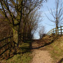
Albert Village circular walk
Distance: 5 miles
Terrain: Easy, mostly surfaced and forest paths.
Location: Derbyshire / Leicestershire border close to Albert Village
On map: Ordnance Survey Explorer 245 (National Forest)
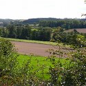
Ticknall Circular Walk
Distance: 6 miles
Terrain: some gentle inclines, stiles, fields
Location: Foremark Reservoir, South Derbyshire
On map: Ordnance Survey Explorer 245 (National Forest)
Staunton Harold Walk
Distance: 6.1 miles
Terrain: Easy, but quite a bit of road.
Location: Derbyshire / Leicestershire border close to Melbourne, Calke, Staunton Harold
On map: Ordnance Survey Explorer 245 (National Forest)
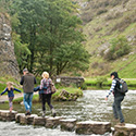
Dovedale and Milldale Walk
Distance: 6 miles
Terrain: riverside, well-maintained surfaced path
Location: Close to Alstonefield or Ilam, Peak District.
On map: Ordnance Survey Explorer OL24 (White Peak)
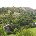
Bakewell to Monsal Head and Monsal Dale Viaduct
Distance: 8 miles
Terrain: dismantled railway, optional descent down into Monsal valley
Location: Bakewell, Peak District.
On map: Ordnance Survey Explorer OL24 (White Peak)
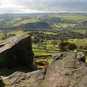
Froggatt Edge (short) walk
Distance: 9 miles
Terrain: Very good terrain with a climb to 340m
Location: Baslow, Peak District.
On map: Ordnance Survey Explorer OL24 (White Peak)
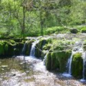
Lathkill Dale and Youlgrave (shorter version)
Distance: 11.5 miles
Terrain: some steep climbs. Total ascent: 200m (lowest point to highest point)
Location: Alport, Youlgrave, Middleton, Peak District.
Summary: Starting at Alport, along the Lathkill Dale, onto Limestone Way via Moneyash, Midshires way and on to Middleton, divert south East to pick up Limestone Way back to Youlgrave.
On map: Ordnance Survey Explorer OL24 (White Peak)
Lathkill Dale and Youlgrave
Distance: 13 miles
Terrain: some steep climbs. Total ascent: 200m (lowest point to highest point)
Location: Alport, Youlgrave, Middleton, Peak District.
Summary: Starting at Alport, along the Lathkill Dale, onto Limestone Way via Moneyash, Midshires way and on to Middleton, divert south East to pick up Limestone Way back to Youlgrave.
On map: Ordnance Survey Explorer OL24 (White Peak)
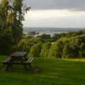
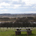
South Derbyshire Viewpoints Walk
Distance: 14 miles
Terrain: Some fields and woods, some inclines
Location: South Derbyshire
Time: 6 hours start to finish
On map: Ordnance Survey Explorer 245 (National Forest)
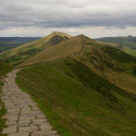
Win Some, Lose Some
Distance: 16 miles
Terrain: good flagged paths, ascents to 517m
Location: Castleton / Ladybower Reservoir, Peak District
Time: 8 hours start to finish
On map: Ordnance Survey Explorer OL1 (Dark Peak)
South Derbyshire 18 Walk
Distance: 18 miles
Terrain: Some fields and woods, some inclines
Location: South Derbyshire.
Time: 8 hours start to finish
On map: Ordnance Survey Explorer 245
Froggatt Edge (long) walk
Distance: 20 miles
Terrain: Very good terrain with a climb to 340m
Location: Baslow, Peak District.
On map: Ordnance Survey Explorer OL24 (White Peak)
Unlimited listening to thousands of titles:
