Walks
Why use an ordnance survey map for walking rather than a handheld device?
The Explorer map (1:25,000) shows the contours of the land, field boundaries, buildings and churches, viewpoints, and most importantly, the footpaths that you have a right to walk along
Reading a map is easier than you think. It's not going to tell you "turn left here", you have to work that out for yourself. (Which is actually one of the reasons *for* using a map.) But there are some important reasons for taking a map as well as or instead.
- You get to see the bigger picture. Open the map out a bit and you will see a very big area in great detail. You will have a better idea in your head of your surroundings and where you are in them.
- Your map won't fail. Your handheld device can fail because of a technical fault or batteries failing because of wet, cold or just running out. A paper map can turn into papier mache in a deluge, but if that's possible, put it in a map holder or use a waterproof map.
- Satisfaction. Navigating is a skill. If you've devised your route yourself and navigated your way around it, you'll feel much more smug as you sip your pint afterwards than if you'd let your electronic device you around.
Of course your map won't tell you where you are. Unless you're in a featureless area (very unusual) or in heavy fog / cloud then you'll be able to work out where you are on the map. If you want to have your gps with you for these emergencies or to help you with the navigation, then you'll be better prepared, but don't rely on it entirely.
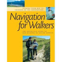
Navigation for Walkers by Julian Tippett
The definitive guide to reading your Ordnance Survey map. From first steps to expert.

