Walks
Rutland Water Brooke Circular Walk
Distance: 5.4 miles
Terrain: gentle incline to about 40 metres above starting point
View / download the route
map: Ordnance Survey Explorer 234 (Rutland Water)
My last walk: 11 May 2021
I suggest parking and starting this walk at Horse and Jockey Inn, Manton. Head up the hill and right onto the Lynton Road.
After carefully crossing the road at a huge junction, keep heading straight along the bridleway. After a couple of fields it's easy to veer off to the right but look out for the fascinating short avenue of hawthorn trees. Stick roughly to the highest point of the land and head just to the left of the building you come to.
This area is marked on the map as a mediaeval village, but apart from the building, there's no evidence of anything standing, just grassy fields, earthworks and some ridge and furrow. The building is known as Old Hall Farm and is all that's left of a large mansion.
After passing the building, join a farm track and a little further there's an information board which will give you more information about the mediaeval settlement.
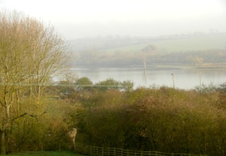
 Still on the farm track. Despite this being the highest point now of this walk, you will still only see glimpses of the water, not the whole reservoir. The track turns into a road, turn right at the junction.
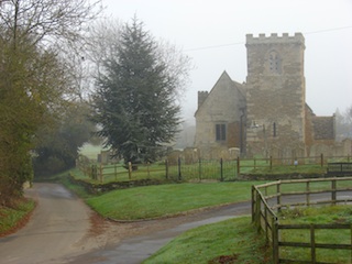
After Brooke, which is a pretty village with a lovely church, the road gets smaller and becomes a track. Just before a sign which says 'vehicular access to Hillside Cottage', take the path to your right. Which is signposted Bridleway to Gunthorpe. It shortly opens out into a field with an apparent fork; it's the left-hand fork which is the path. A few minutes later, something similar happens, the path forks to the left and right of a hedge. The correct path is to the left of the hedge. Beware of the track going into the farmyard, you need to turn off the track before the farmyard and head into the corner of the field where there is a green gate, easy to miss. Look out for the yellow disc waymarkers.
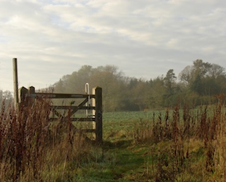 After Gunthorpe and entering a field, the path officially goes in a straight line across the middle of the field. there may be a crop growing (and therefore no path) but it's very easy to walk around the edge of the field to the left, it's not much further.
Just after leaving that field, we're now at a high point and the best viewpoint on this return leg of the walk before descending down to the road. Cross the railway line carefully, there is a 'stop/go' traffic light. When you pick up the circuit of Rutland Water, follow it back to the Horse and Jockey - well-signposted.
Osprey webcam at Lyndon Nature Reserve - Rutland Water is home to the first Ospreys to breed in England for 150 years. View the webcam
More photos of this walk on Flickr:
View / download the route
Below is an interactive map with the route shown on it, which you can make full-screen. To take a paper map with you at the best detail, you will need an explorer (1:25,000) map. Please use the link below to buy a copy. Below the map is a link to download the GPX file which you can open in many mapping and navigation apps, including OsmAnd (Open Street Map) and OSMaps (Ordnance Survey)
Download GPX file for the Rutland Water Brooke Circular Walk
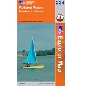
This walk uses Ordnance Survey Explorer 234 Rutland Water
1:25,000 scale map Rutland Water. Includes Stamford and Oakham. Click the thumbnail for more information
Note that OS paper maps now include the digital / mobile map, downloadable and viewable *offline* in the OSMaps app. The routes provided on these pages in GPX format will open and display over the digital mapping in the OSMaps app.
Unlimited listening to thousands of titles:
