Walks
Lathkill Dale and Youlgreave Circular Walk (shorter version)
Distance: 11.5 miles
Time: 5 hours
Terrain: mostly good surfaced paths, some inclines, stiles
Summary: Starting at Youlgrave, along the Lathkill Dale, onto Limestone Way via Moneyash, back to Youlgrave along Limestone Way.
Starting location: [ Youlgreave ]
Map: Explorer OL24 (White Peak)
My last walk: 21 April 2011
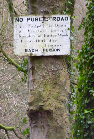 The first half of this walk is down in dales and cycle routes and is beautiful. From Alport, use a track to get to Over Haddon, and then down into the Dale. The first part of the path alongside the water is marked with a brown line before changing to green later on. This means that it's not a public right of way, but some kind of concessionary path. It obviously has some history, because you first see this old sign which explains that it's free to use the path, except for the thursday of Easter week, when there is a toll. The photograph (taken a few years ago) shows a presumably long-standing toll of one penny! More recntly, this sign has been changed for a new one showing a toll of 20p.
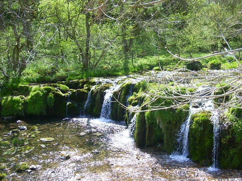
The map shows a good flow of water emerging apparently from nowhere. Look out for this point - there's a large cave mouth which springs forth the water, unless it's been very dry, in which case you can still see the cave but without the water.
 Continue until you meet a road and turn left for Monyash. At the church pick up the footpath which will take you onto the Limestone Way. It's quite easy to follow the signs for the Limestone Way which will take you back to Youlgrave via another beautiful Dale marked River Bradford.
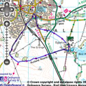
View the route
The link to the right will show you an interactive map with the route shown on it, provided free to you at this level of detail by the lovely folk at OS. The detail on it will be the equivalent of the Landranger map (1:50,000). For the full detail and a map you can carry around the walk with you, you will need an explorer (1:25,000) map. Please use the link below to buy a copy.
blog posts about this walk:
- http://peacockmedia.blogspot.com/2008/02/youlgrave.html
- http://peacockmedia.blogspot.com/2011/04/lathkill-dale-and-youlgreave-spring.html
Photos on Flickr:
View the route
The link to the right will show you an interactive map with the route shown on it, provided free to you at this level of detail by the lovely folk at OS. The detail on it will be the equivalent of the Landranger map (1:50,000). For the full detail and a map you can carry around the walk with you, you will need an explorer (1:25,000) map. Please use the link below to buy a copy.
This walk uses Ordnance Survey map Explorer OL24 (White Peak)
Unlimited listening to thousands of titles:
