Walks
Ivanhoe Way - Leicestershire Circular Walk
 Distance: 36 miles
Time: The Ivanhoe Way challenge is to complete the route in under 15 hours.
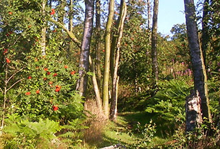
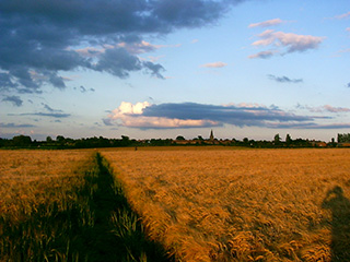
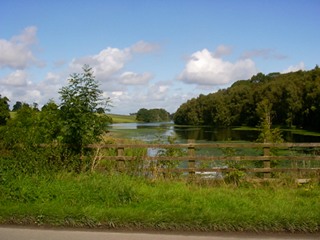
Terrain: A wide variety of terrain - open country and crop fields, hills, woodland, canal towpath, dismantled railway, road and the odd housing estate.
Starting location: Anywhere en route, suggest Ashby de la Zouch, Leicestershire
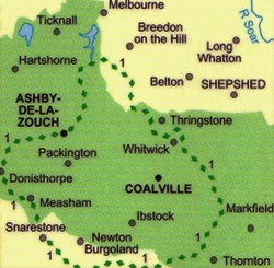
Map: Route is marked with green diamonds on Explorer 245 (National Forest)
My last walk: 2nd October 2011
The notes below are to accompany you, not to guide you. Use a paper map, preferably 1:25,00 (Explorer 245 (National Forest))
 The Ivanhoe Way is one of Leicestershire's long-distance paths, created by Leicestershire County Council and the Leicestershire Association of Parish and Local Councils, to celebrate the centenary of civil Parish Councils in 1994.
At 36 miles, it's possible to do in a single day, but in mid-summer if you want to do it all in daylight. it's also possible to do as a series of shorter walks.
The Ivanhoe Way is one of Leicestershire's long-distance paths, created by Leicestershire County Council and the Leicestershire Association of Parish and Local Councils, to celebrate the centenary of civil Parish Councils in 1994.
At 36 miles, it's possible to do in a single day, but in mid-summer if you want to do it all in daylight. it's also possible to do as a series of shorter walks.
Ivanhoe Way Challenge - If you'd like to join an organised group and raise money for charity at the same time, you could join the Ivanhoe Way Challenge usually in June. More about this event
 The largest towns the route passes through are Ashby de la Zouch and Measham. They're fairly close together and will be the best places for topping up on provisions. Ashby has a large number of shops and public toilets (at the bottom of the town close to Somerfield supermarket). Ashby may be a convenient place to start / finish, as it has good car parking.
 The route is clearly marked on Explorer 245. Pubs en route are also shown on the Explorer map. There's also a good guide available from Leicestershire County Council. This used to cost a pound, but I see that it's now free - unfortunately not available for download - you have to contact them or visit one of their TICs for a printed copy. It's also well worth printing off a copy of their web page as it lists some erata and updates to the maps and leaflet:
As far as I can see, Leicestershire County Council no longer publish any information about the Ivanhoe Way on their website.
 The route passes convenience stores at:
- Ashby de la Zouch SK359168
- Measham SK332119
- Thringstone SK431165
- Stanton under Bardon SK466105
Here are my own comments which I'd add to Leicestershire's list. (Note that LCC's comments are written from the point of view of walking the route clockwise, I've written mine as I walk anti-clockwise.)
- Just beyond Ashby (or before Ashby depending on which direction you're walking) at SK332166 I have found an 'Ivanhoe Way' fingerpost pointing towards Ashby, which I think is wrong unless the path has been moved. I've always walked across fields between Shellbrook and Norris Hill, which is the route shown on my map. The fingerpost is way off the Ivanhoe Way which could be confusing, although whichever direction you're walking the IW, if you see that sign and keep walking along the road you'll rejoin the IW.
- At SK457142 Leicestershire's notes describe a variation between older and newer maps and their leaflet. The Ivanhoe Way signposts direct you through a housing estate. Some OS maps show that, while some show the Ivanhoe Way as using Agar Nook Lane which skirts the estate. LCC notes these two options, my own feeling is that Agar Nook Lane is a much more pleasant walk, and so that's the one I use.
- At SK374070, the Ivanhoe Way briefly goes off the bottom of Explorer 245!
- Between SK380073 (Shackerstone) and SK450080 (Bagworth) the Ivanhoe Way and Leicestershire Round share the same paths. Some signposts just say "Leicestershire Round" (or give the 3-arrows-in-a-circle symbol). (Since I first made this comment, discs have been added and the situation is improved.)
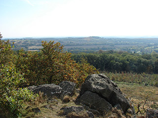
- Bardon Hill is at SK461132. The Ivanhoe Way doesn't go to the top of the hill, but skirts around the edge. There is a footpath to the top and down the other side, and a great view from the top, and so I prefer to do that.
- At Bagworth SK445085, the map shows a footpath marked with diamonds heading up the road towards Coalville, then looping back along a railway line. There's also a footpath with diamonds heading in a straight line through Bagworth, crossing a couple of fields and then under the same railway line. On the map, neither is marked Ivanhoe Way, but on the ground, both possibilities have Ivanhoe Way waymarkers. The Ivanhoe Way leaflet gives both routes as options.
- I would also add - simply because I have got lost myself at this point - that just beyond Bagworth (if you're walking anti-clockwise), point SK452082, watch your compass and keep heading north-east. Don't cross the footbridge, or go down into the boggy part of that field, keep it to your right and look for the waymarker well to the left of it. A wooden fence joining the footbridge isn't marked on the map. There's a railway bridge in the distance which you should head straight for.
And my tips.
- Plan to be out for at least 15 hours - this means doing the walk as close as possible to midsummer (mid-June) or navigating in the dark.
- Take a torch with you even if you plan to finish in daylight. It could easily take longer than you expect.
- Take a map. Never navigate using wayposts only.
- As you pass through Ashby, look for 'Memory Lane Sweets' and buy one of their delicious ice-creams.
- Provisions can also be bought in Ashby, Measham, Thringstone, Stanton and Moira Furnace.
- Ashby has public toilets.
blog posts about this walk:
- http://peacockmedia.blogspot.com/2008/08/ivanhoe-way.html
- http://peacockmedia.blogspot.com/2009/07/ivanhoe-way-2009.html
- http://peacockmedia.blogspot.com/2010/09/ivanhoe-way-challenge-2010.html
- I didn't blog my 2011 attempt but the photos with comments are here
This walk is marked with green diamonds on Ordnance Survey map Explorer 245 (National Forest)
Unlimited listening to thousands of titles:
